Our mission is to help computational modelers develop, document, and share their computational models in accordance with community standards and good open science and software engineering practices. Model authors can publish their model source code in the Computational Model Library with narrative documentation as well as metadata that supports open science and emerging norms that facilitate software citation, computational reproducibility / frictionless reuse, and interoperability. Model authors can also request private peer review of their computational models. Models that pass peer review receive a DOI once published.
All users of models published in the library must cite model authors when they use and benefit from their code.
Please check out our model publishing tutorial and feel free to contact us if you have any questions or concerns about publishing your model(s) in the Computational Model Library.
Displaying 10 of 74 results urban clear search
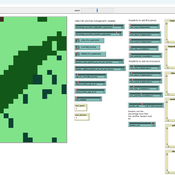
Fire-WCISG
Sven Christ | Published Saturday, July 25, 2026An integrated wildfire and urban growth model for informal settlements.
Fire-WCISG is developed to test the impact of different fire management strategies on the number and type of residents staying in an informal settlement, and the fire-dependent fynbos vegetation that it is next to.
The model uses a hybrid protection motivation theory, place attachment and Turner’s informal residents as described by Christ et al. (2023) (10.1016/j.habitatint.2023.102815), for the agents decision making. Wildland vegetation is based on published understanding of fynbos ecology.
…
Asymmetric Demographic Hysteresis in a Spatial Agent-Based Urban System
Chen Shen | Published Friday, July 24, 2026This paper develops a spatial agent-based model to examine how fertility regime shifts reshape population concentration and wealth distribution in an abstract urban system. Migration decisions combine population preference, cultural homophily, expected net income, and resource endowment through a standardised softmax utility. The design is deliberately stylised: it is not calibrated to a particular country or city system, but is intended to isolate the feedbacks linking migration, fertility, urban scaling, and accumulated wealth.
The simulations reveal robust directional asymmetry. When fertility shifts from low to high, population concentration responds rapidly; when fertility shifts from high to low, concentration declines only after a detectable delay and may temporarily continue in the previous direction. Wealth adds a second layer of hysteresis: cell total-wealth concentration follows population concentration with delay, cell mean-wealth inequality and system-level wealth indicators are slower still, and phase-space trajectories form loops rather than collapsing onto a single population–wealth curve. Robustness experiments indicate that longer fertility cycles, wider mobility neighbourhoods, and smoother resource landscapes change the magnitude of delay and overshoot, but do not remove the qualitative asymmetry. The paper argues that demographic decline should be understood not as the mirror image of demographic expansion, but as a path-dependent transition mediated by fast migration-income feedbacks and slower fertility, cohort, culture, and wealth mechanisms.
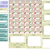
Amber Dilemma Zone: Driver Cognition and Signal Control in Urban Traffic
Mansoor Abdul Bari | Published Sunday, July 19, 2026This model is an extension of Wilensky’s (2003) Traffic Grid, a foundational NetLogo model of urban traffic flow. It embeds a dual-process cognitive architecture into each driver agent, transforming the original’s identical reactive units into cognitively heterogeneous individuals whose internal mental state evolves with experience; making the same intersection produce different decisions from different drivers, and different decisions from the same driver across occasions.
The core question the model addresses is the yellow-light dilemma zone: the seconds following amber onset in which a driver can neither stop safely nor clear the intersection before red. Field research documents that behavioral variance at this moment cannot be explained by geometry or legal obligation alone. This model provides the cognitive architecture that has been missing from traffic ABMs.
Each driver routes every amber-onset decision through either System 1 (fast, heuristic, automatic) or System 2 (slow, deliberative, prospect-theoretic), switching dynamically based on cognitive load, accumulated near-miss memory, and situational framing. The result is crash outcomes that are attributable, path-dependent, and sensitive to both driver disposition and signal infrastructure; none of which fixed-rule models can reproduce. Three signal control modes are included: fixed-cycle (replicating Wilensky’s original), adaptive-queue, and smart occupancy-based switching.
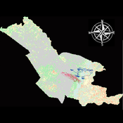
Agent modeling (ABM) as a tool to improve the mobility of “avoidant” birds in an ecological corridor in the localities of Chapinero, Teusaquillo, Barrios Unidos and Engativá of Bogotá city [Scenario 2]
Paula Alejandra Meza | Published Thursday, June 25, 2026Considering that two of the three avoider species could not reach the target area in the inittial scenario, five alternative corridor scenarios were created. In all cases, we generated a greater amount of cover area under ‘Urban forest’, including elements such as scattered trees, woody plants, wooded areas, and rows of trees. This covered type was selected since all three species use it as a regular habitat. That is the second sceneario where those ecological parks and other areas inside the capital city were boostered into “urban forest patches” or buffer points, with the idea of improving the survive of the three bird species and their movement. However one of the most restrictive specie was still having movement and survival issues.
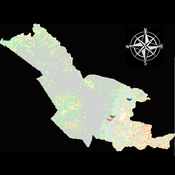
Agent modeling (ABM) as a tool to improve the mobility of “avoidant” birds in an ecological corridor in the localities of Chapinero, Teusaquillo, Barrios Unidos and Engativá of Bogotá city
Paula Alejandra Meza Maria Angela Echeverry-Galvis Mauricio González Méndez | Published Wednesday, June 24, 2026The purpose of this model is to analyze different configurations and scenarios of ecological corridors to simulate the movement of three avoider bird species at a local scale: Chondrohierax uncinatus (Accipitridae), a large carnivorous bird; Ampelion rubrocristatus (Cotingidae), a species that seeks areas with substantial land cover for refuge and rest; and Coeligena bonapartei (Trochilidae), a large hummingbird that prefers areas with a rich and diverse food supply. The model focusses on juvenile bird individuals seeking refuge and food, taking into account the mobility parameters of each species and the existing land cover types within the study area.
Specifically, the model aims to:
• Simulate the movement of 45 avoiders birds which are considered umbrella species sensitive to urban changes (which were chosen based on their specific biological and ecological requirements and parameters relevant to urban conservation efforts), 15 avoiders birds per specie to cross a two-dimensional world predominant urban.
• To be able to select which corridor scenario would be the most beneficial, in order to help the mobility of other species affected by urban fragmentation.
• Contribute to urban ecology research and support decision-making processes by relevant stakeholders.
Simulating Climate Stress and Social Instability: An Agent-Based Model of Ecosystem Degradation and Violence in Coastal Communities
Jacopo A. Baggio hurtado-valdivieso | Published Sunday, April 12, 2026This model is an agent-based simulation designed to explore how climate-induced environmental degradation can contribute to the emergence of social violence in coastal communities that depend heavily on ecosystem services for their livelihoods. The model represents a coupled social–ecological system in which environmental shocks—such as sea level rise and marine ecosystem decline—affect local economic conditions, food security, and community stability.
Agents in the model represent individuals whose livelihoods depend on coastal ecosystems. Environmental degradation reduces ecosystem productivity and increases economic hardship, which can lead to the formation of grievances among agents. The model incorporates behavioral thresholds that determine how individuals respond to hardship and perceived injustice. Under certain conditions—particularly when institutional capacity and law enforcement effectiveness are limited—these grievances may escalate into violent behavior.
The simulation allows users to explore how different climate scenarios, levels of ecosystem degradation, livelihood dependence, and institutional responses influence the probability of social instability and violence. By modeling the interactions between environmental stress, socio-economic vulnerability, and governance capacity, the model provides a computational framework for examining potential pathways linking climate change and conflict in coastal social–ecological systems.
…
A simulation model for Dublin city
umesh7lowe | Published Friday, April 10, 2026An agent-based model of urban travel behaviour in Dublin, Ireland, built in NetLogo and empirically grounded in 2016 travel survey data. Each agent represents a Dublin resident initialised with real socio-demographic attributes — including age, gender, household size and car ownership, income, driving licence status, and access to local amenities — alongside observed trip characteristics such as distance, travel time, and trip type (work, shopping, leisure).
At each time step, agents choose between four transport modes (car, public transport, cycling, and walking) across short, medium, and long trips. Mode choice is governed by a preference vector that weighs personal need satisfaction against social influence from neighbouring agents reflecting consumat framework. Satisfaction evolves dynamically based on cost (incorporating Irish motor tax bands and per-km operating rates), travel time, and trip-type suitability, with an uncertainty parameter capturing variability in perceived utility over time.
The model tracks aggregate modal shares and total CO2 emission at each tick, enabling exploration of how policy interventions — such as fuel taxation, public transport pricing, or active travel incentives — might shift the city’s travel demand profile over 100 simulated days.
Geospatial Agent-Based Model of Immigrant Settlement Dynamics in Metro Vancouver
Liliana Perez Navid Mahdizadeh Gharakhanlou Maryam Yousefi | Published Wednesday, December 03, 2025This agent-based model simulates how new immigrant households choose where to live in Metro Vancouver under the origins diversity scenario. The model begins with 16,000 household agents, reflecting an expected annual population increase of about 42,500 people based on an average household size of 2.56. Each agent is assigned four characteristics: one of ten origin categories, income level (adjusted using NOC data and recent immigrant earnings), likelihood of having children, and preferred mode of commuting. The ten origin groups are drawn from Census patterns, including six subgroups within the broader Asian category (China, India, the Philippines, Iran, South Korea, and Other Asian countries) and two categories for immigrants from the Americas. This refined classification better captures the diversity of newcomers arriving in the region.
Urban Teacher Lifecycle and Mobility
Yevgeny Patarakin | Published Wednesday, July 23, 2025This agent-based model simulates the lifecycle, movement, and satisfaction of teachers within an urban educational system composed of multiple universities and schools. Each teacher agent transitions through several possible roles: newcomer, university student, unemployed graduate, and employed teacher. Teachers’ pathways are shaped by spatial configuration, institutional capacities, individual characteristics, and dynamic interactions with schools and universities. Universities are assigned spatial locations with a controllable level of centralization and are characterized by academic ratings, capacity, and alumni records. Schools are distributed throughout the city, each with a limited number of vacancies, hiring requirements, and offered salaries. Teachers apply to universities based on the alignment of their personal academic profiles with institutional ratings, pursue studies, and upon graduation become candidates for employment at schools.
The employment process is driven by a decentralized matching of teacher expectations and school offers, taking into account factors such as salary, proximity, and peer similarity. Teachers’ satisfaction evolves over time, reflecting both institutional characteristics and the composition of their colleagues; low satisfaction may prompt teachers to transfer between schools within their mobility radius. Mortality and teacher attrition further shape workforce dynamics, leading to continuous recruitment of newcomers to maintain a stable population. The model tracks university reputation through the academic performance and number of alumni, and visualizes key metrics including teacher status distribution, school staffing, university alumni counts, and overall satisfaction. This structure enables the exploration of policy interventions, hiring and training strategies, and the impact of spatial and institutional design on the allocation, retention, and happiness of urban educational staff.
Tragedy of the Commons with Environmental Feedback: A Model of Human-AI Socio-Environmental Water Dilemma
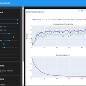
Ivana Malcic Luka Waronig Andrew Crossley | Published Saturday, July 05, 2025 | Last modified Sunday, July 06, 2025This project is an interactive agent-based model simulating consumption of a shared, renewable resource using a game-theoretic framework with environmental feedback. The primary function of this model was to test how resource-use among AI and human agents degrades the environment, and to explore the socio-environmental feedback loops that lead to complex emergent system dynamics. We implemented a classic game theoretic matrix which decides agents´ strategies, and added a feedback loop which switches between strategies in pristine vs degraded environments. This leads to cooperation in bad environments, and defection in good ones.
Despite this use, it can be applicable for a variety of other scenarios including simulating climate disasters, environmental sensitivity to resource consumption, or influence of environmental degradation to agent behaviour.
The ABM was inspired by the Weitz et. al. (2016, https://pubmed.ncbi.nlm.nih.gov/27830651/) use of environmental feedback in their paper, as well as the Demographic Prisoner’s Dilemma on a Grid model (https://mesa.readthedocs.io/stable/examples/advanced/pd_grid.html#demographic-prisoner-s-dilemma-on-a-grid). The main innovation is the added environmental feedback with local resource replenishment.
Beyond its theoretical insights into coevolutionary dynamics, it serves as a versatile tool with several practical applications. For urban planners and policymakers, the model can function as a ”digital sandbox” for testing the impacts of locating high-consumption industrial agents, such as data centers, in proximity to residential communities. It allows for the exploration of different urban densities, and the evaluation of policy interventions—such as taxes on defection or subsidies for cooperation—by directly modifying the agents’ resource consumptions to observe effects on resource health. Furthermore, the model provides a framework for assessing the resilience of such socio-environmental systems to external shocks.
…
Displaying 10 of 74 results urban clear search