
Navid Mahdizadeh Gharakhanlou
Personal homepagehttps://www.linkedin.com/in/navid-mahdizadeh-gharakhanlou-95b6b5141/
Professional homepagehttps://www.linkedin.com/in/navid-mahdizadeh-gharakhanlou-95b6b5141/
ORCID more infohttps://orcid.org/0000-0001-6762-9012
GitHub more info
• GIS Analyst / GIS Specialist: Experienced in applying GIS tools and spatial analysis techniques to
support decision-making in urban planning, environmental management, transportation, and infrastructure
projects. Skilled in producing high-quality maps, conducting spatial analysis, and delivering actionable
geospatial insights for operational and policy use.
• Geospatial Data Scientist: Specialized in developing spatial predictive models by integrating machine
learning and geospatial data to perform risk assessment, suitability analysis, and forecasting using large-
scale datasets such as satellite imagery, climate variables, and land-use data.
• Spatial Data Engineering & Processing: Strong ability to manage and preprocess complex geospatial
datasets, including raster and vector data, DEMs, remote sensing products, and climate projections, with
rigorous attention to spatial reference systems, accuracy, and data quality control.
• GIS Workflow Automation & Optimization: Proven experience in automating geospatial workflows
using ArcGIS Pro, ArcPy, ModelBuilder, FME (ETL), and Python to improve efficiency in spatial analysis,
data processing, and large-scale mapping tasks.
• Remote Sensing & Earth Observation Analysis: Proficient in satellite imagery processing and analysis,
including cloud masking, spectral analysis, vegetation indices, land cover classification, and temporal
change detection using Google Earth Engine and Python.
• Geospatial Visualization & Cartography: Skilled in producing professional-grade thematic maps, spa-
tial dashboards, and web-based geovisualizations to communicate complex geospatial patterns to both
technical and non-technical stakeholders.
• Cross-Disciplinary Collaboration: Experienced working with multidisciplinary teams across academia,
government, and industry to deliver geospatial solutions for planning, environmental risk assessment, and
policy-driven decision-making.
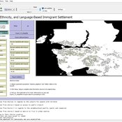
Geospatial Agent-Based Model of Immigrant Settlement Dynamics in Metro Vancouver
Liliana Perez Navid Mahdizadeh Gharakhanlou Maryam Yousefi | Published Wednesday, December 03, 2025This agent-based model simulates how new immigrant households choose where to live in Metro Vancouver under the origins diversity scenario. The model begins with 16,000 household agents, reflecting an expected annual population increase of about 42,500 people based on an average household size of 2.56. Each agent is assigned four characteristics: one of ten origin categories, income level (adjusted using NOC data and recent immigrant earnings), likelihood of having children, and preferred mode of commuting. The ten origin groups are drawn from Census patterns, including six subgroups within the broader Asian category (China, India, the Philippines, Iran, South Korea, and Other Asian countries) and two categories for immigrants from the Americas. This refined classification better captures the diversity of newcomers arriving in the region.
Under development.