About the CoMSES Model Library more info
Our mission is to help computational modelers develop, document, and share their computational models in accordance with community standards and good open science and software engineering practices. Model authors can publish their model source code in the Computational Model Library with narrative documentation as well as metadata that supports open science and emerging norms that facilitate software citation, computational reproducibility / frictionless reuse, and interoperability. Model authors can also request private peer review of their computational models. Models that pass peer review receive a DOI once published.
All users of models published in the library must cite model authors when they use and benefit from their code.
Please check out our model publishing tutorial and feel free to contact us if you have any questions or concerns about publishing your model(s) in the Computational Model Library.
We also maintain a curated database of over 7500 publications of agent-based and individual based models with detailed metadata on availability of code and bibliometric information on the landscape of ABM/IBM publications that we welcome you to explore.
Displaying 10 of 1246 results
Population size limits the coefficient of variation in continuous traits affected by proportional copying error
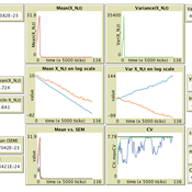
Luke Premo | Published Thursday, June 18, 2020This version of the accumulated copying error (ACE) model is designed to address the following research question: how does finite population size (N) affect the coefficient of variation (CV) of a continuous cultural trait under the assumptions that the only source of copying error is visual perception error and that the continuous trait can take any positive value (i.e., it has no upper bound)? The model allows one to address this question while assuming the continuous trait is transmitted via vertical transmission, unbiased transmission, prestige biased transmission, mean conformist transmission, or median conformist transmission. By varying the parameter, p, one can also investigate the effect of population size under a mix of vertical and non-vertical transmission, whereby on average (1-p)N individuals learn via vertical transmission and pN individuals learn via either unbiased transmission, prestige biased transmission, mean conformist transmission, or median conformist transmission.
Peer reviewed JuSt-Social COVID-19
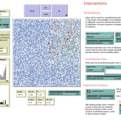
Jennifer Badham | Published Thursday, June 18, 2020 | Last modified Monday, March 29, 2021NetLogo model that allows scenarios concerning general social distancing, shielding of high-risk individuals, and informing contacts when symptomatic. Documentation includes a user manual with some simple scenarios, and technical information including descriptions of key procedures and parameter values.
Peer reviewed OfficeMoves: Personalities and Performance in an Interdependent Environment
Alan Dugger | Published Thursday, June 11, 2020After a little work experience, we realize that different kinds of people prefer different work environments: some enjoy a fast-paced challenge; some want to get by; and, others want to show off.
From that experience, we also realize that different kinds of people affect their work environments differently: some increase the pace; some slow it down; and, others make it about themselves.
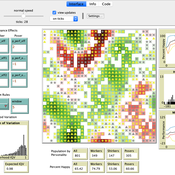
This model concerns how three different kinds of people affect their work environment and how that work environment affects them in return. The model explores how this circular relation between people’s preferences and their environment creates patterns of association and performance over time.
…
Threshold Public Goods Game Models with Punishment
Martin Zoričak Vladimir Gazda Gabriela Koľveková Manuela Raisová | Published Saturday, June 06, 2020This is a set of threshold public goods games models. Set consists of baseline model, endogenous shared punishment model, endogenous shared punishment model with activists and cooperation model. In each round, all agents are granted a budget of size set in GUI. Then they decide on how much they contribute to public goods and how much they keep. Public goods are provided only if the sum of contributions meets or exceeds the threshold defined in the GUI. After each round agents evaluate their strategy and payoff from this strategy.
The NetLogo HIV Spread Model Exploring Impact of PrEP Indication Guidelines
Uri Wilensky Wouter Vermeer Arthur Hjorth | Published Friday, June 05, 2020This agent-based model was built as part of a replication effort of Jeness et al.’s work (linked below). The model simulates an MSM sexual activity network for the purpose of modeling the effects of respectively PrEP and ART on HIV prevention. The purpose of the model is to explore the differences between differerent interpretations of the NIH Indication Guidelines for PrEP.
The Internal Organizational Plasticity Model (IOP 2.1.2)
Davide Secchi | Published Tuesday, June 02, 2020IOP 2.1.2 is an agent-based simulation model designed to explore the relations between (1) employees, (2) tasks and (3) resources in an organizational setting. By comparing alternative cognitive strategies in the use of resources, employees face increasingly demanding waves of tasks that derive by challenges the organization face to adapt to a turbulent environment. The assumption tested by this model is that a successful organizational adaptation, called plastic, is necessarily tied to how employees handle pressure coming from existing and new tasks. By comparing alternative cognitive strategies, connected to ‘docility’ (Simon, 1993; Secchi, 2011) and ‘extended’ cognition (Clark, 2003, Secchi & Cowley, 2018), IOP 2.1.2 is an attempt to indicate which strategy is most suitable and under which scenario.
Peer reviewed COMOKIT
Patrick Taillandier Alexis Drogoul Benoit Gaudou Kevin Chapuis Nghi Huyng Quang Doanh Nguyen Ngoc Arthur Brugière Pierre Larmande Marc Choisy Damien Philippon | Published Tuesday, May 26, 2020 | Last modified Wednesday, July 01, 2020In the face of the COVID-19 pandemic, public health authorities around the world have experimented, in a short period of time, with various combinations of interventions at different scales. However, as the pandemic continues to progress, there is a growing need for tools and methodologies to quickly analyze the impact of these interventions and answer concrete questions regarding their effectiveness, range and temporality.
COMOKIT, the COVID-19 modeling kit, is such a tool. It is a computer model that allows intervention strategies to be explored in silico before their possible implementation phase. It can take into account important dimensions of policy actions, such as the heterogeneity of individual responses or the spatial aspect of containment strategies.
In COMOKIT, built using the agent-based modeling and simulation platform GAMA, the profiles, activities and interactions of people, person-to-person and environmental transmissions, individual clinical statuses, public health policies and interventions are explicitly represented and they all serve as a basis for describing the dynamics of the epidemic in a detailed and realistic representation of space.
…
Wildlife-Human Interactions in Shared Landscapes (WHISL)
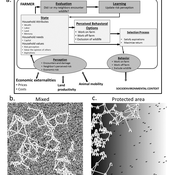
Nicholas Magliocca Neil Carter Andres Baeza-Castro | Published Friday, May 22, 2020This model simulates a group of farmers that have encounters with individuals of a wildlife population. Each farmer owns a set of cells that represent their farm. Each farmer must decide what cells inside their farm will be used to produce an agricultural good that is self in an external market at a given price. The farmer must decide to protect the farm from potential encounters with individuals of the wildlife population. This decision in the model is called “fencing”. Each time that a cell is fenced, the chances of a wildlife individual to move to that cell is reduced. Each encounter reduces the productive outcome obtained of the affected cell. Farmers, therefore, can reduce the risk of encounters by exclusion. The decision of excluding wildlife is made considering the perception of risk of encounters. In the model, the perception of risk is subjective, as it depends on past encounters and on the perception of risk from other farmers in the community. The community of farmers passes information about this risk perception through a social network. The user (observer) of the model can control the importance of the social network on the individual perception of risk.
The Coevolution of the Firm and the Product Attribute Space
César García-Díaz | Published Friday, May 22, 2020This model inspects the performance of firms as the product attribute space changes, which evolves as a consequence of firms’ actions. Firms may create new product variants by dragging demand from other existing variants. Firms decide whether to open new product variants, to invade existing ones, or to keep their variant portfolio. At each variant there is a Cournot competition each round. Competition is nested since many firms compete at many variants simultaneously, affecting firm composition at each location (variant).
After the Cournot outcomes, at each round firms decide whether to (i) keep their existing product variant niche, (ii) invade an existing variant, (iii) create a new variant, or (iv) abandon a variant. Firms’ profits across their niche take into consideration the niche-width cost and the cost of opening a new variant.
An agent-based model of building occupant behavior during load shedding
Handi Chandra Putra | Published Thursday, May 21, 2020Load shedding enjoys increasing popularity as a way to reduce power consumption in buildings during hours of peak demand on the electricity grid. This practice has well known cost saving and reliability benefits for the grid, and the contracts utilities sign with their “interruptible” customers often pass on substantial electricity cost savings to participants. Less well-studied are the impacts of load shedding on building occupants, hence this study investigates those impacts on occupant comfort and adaptive behaviors. It documents experience in two office buildings located near Philadelphia (USA) that vary in terms of controllability and the set of adaptive actions available to occupants. An agent-based model (ABM) framework generalizes the case-study insights in a “what-if” format to support operational decision making by building managers and tenants. The framework, implemented in EnergyPlus and NetLogo, simulates occupants that have heterogeneous
thermal and lighting preferences. The simulated occupants pursue local adaptive actions such as adjusting clothing or using portable fans when central building controls are not responsive, and experience organizational constraints, including a corporate dress code and miscommunication with building managers. The model predicts occupant decisions to act fairly well but has limited ability to predict which specific adaptive actions occupants will select.
Displaying 10 of 1246 results
