About the CoMSES Model Library more info
Our mission is to help computational modelers develop, document, and share their computational models in accordance with community standards and good open science and software engineering practices. Model authors can publish their model source code in the Computational Model Library with narrative documentation as well as metadata that supports open science and emerging norms that facilitate software citation, computational reproducibility / frictionless reuse, and interoperability. Model authors can also request private peer review of their computational models. Models that pass peer review receive a DOI once published.
All users of models published in the library must cite model authors when they use and benefit from their code.
Please check out our model publishing tutorial and feel free to contact us if you have any questions or concerns about publishing your model(s) in the Computational Model Library.
We also maintain a curated database of over 7500 publications of agent-based and individual based models with detailed metadata on availability of code and bibliometric information on the landscape of ABM/IBM publications that we welcome you to explore.
Displaying 10 of 1188 results for "Ian M Hamilton" clear search
SBH trust model
Di Wang | Published Tuesday, December 14, 2010 | Last modified Saturday, April 27, 2013This is a computational model to articulate the theory and test some assumption and axioms for the trust model and its relationship to SBH.
Agent-Based Model for Analyzing the Impact of Movement Factors of Sahelian Transhumant Herds
Cheick Amed Diloma Gabriel TRAORE | Published Tuesday, May 28, 2024Transhumants move their herds based on strategies simultaneously considering several environmental and socio-economic factors. There is no agreement on the influence of each factor in these strategies. In addition, there is a discussion about the social aspect of transhumance and how to manage pastoral space. In this context, agent-based modeling can analyze herd movements according to the strategy based on factors favored by the transhumant. This article presents a reductionist agent-based model that simulates herd movements based on a single factor. Model simulations based on algorithms to formalize the behavioral dynamics of transhumants through their strategies. The model results establish that vegetation, water outlets and the socio-economic network of transhumants have a significant temporal impact on transhumance. Water outlets and the socio-economic network have a significant spatial impact. The significant impact of the socio-economic factor demonstrates the social dimension of Sahelian transhumance. Veterinarians and markets have an insignificant spatio-temporal impact. To manage pastoral space, water outlets should be at least 15 km
from each other. The construction of veterinary centers, markets and the securitization of transhumance should be carried out close to villages and rangelands.
Heterogeneity of preferences and the dynamics of voluntary contributions to public goods
Engi Amin Amal Soliman Mohamed Abouelela | Published Thursday, August 18, 2016 | Last modified Thursday, January 25, 2018This model simulates the heterogeneity of preferences in a PG game and how the interaction between them affects the dynamics of voluntary contributions. Model is based on the results of a human-based experiment.
EMMIT (Extendable Model for Malaria Intervention Testing)
Jacob Heintzelman Greg R Madey | Published Thursday, May 27, 2021EMMIT is an end-user developed agent-based simulation of malaria transmission. The simulation’s development is a case study demonstrating an approach for non-technical investigators to easily develop useful simulations of complex public health problems. We focused on malaria transmission, a major global public health problem, and insecticide resistance (IR), a major problem affecting malaria control. Insecticides are used to reduce transmission of malaria caused by the Plasmodium parasite that is spread by the Anopheles mosquito. However, the emergence and spread of IR in a mosquito population can diminish the insecticide’s effectiveness. IR results from mutations that produce behavioral changes or biochemical changes (such as detoxification enhancement, target site alterations) in the mosquito population that provide resistance to the insecticide. Evolutionary selection for the IR traits reduces the effectiveness of an insecticide favoring the resistant mosquito population. It has been suggested that biopesticides, and specifically those that are Late Life Acting (LLA), could address this problem. LLA insecticides exploit Plasmodium’s approximate 10-day extrinsic incubation period in the mosquito vector, a delay that limits malaria transmission to older infected mosquitoes. Since the proposed LLA insecticide delays mosquito death until after the exposed mosquito has a chance to produce several broods of offspring, reducing the selective pressure for resistance, it delays IR development and gives the insecticide longer effectivity. Such insecticides are designed to slow the evolution of IR thus maintaining their effectiveness for malaria control. For the IR problem, EMMIT shows that an LLA insecticide could work as intended, but its operational characteristics are critical, primarily the mean-time-to-death after exposure and the associated standard deviation. We also demonstrate the simulation’s extensibility to other malaria control measures, including larval source control and policies to mitigate the spread of IR. The simulation was developed using NetLogo as a case study of a simple but useful approach to public health research.
Varying effects of connectivity and dispersal on interacting species dynamics
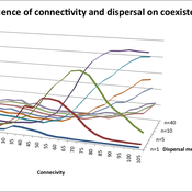
Kehinde Salau | Published Monday, August 29, 2011 | Last modified Saturday, April 27, 2013An agent-based model of species interaction on fragmented landscape is developed to address the question, how do population levels of predators and prey react with respect to changes in the patch connectivity as well as changes in the sharpness of threshold dispersal?
Peer reviewed Historical Letters
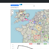
Bernardo Buarque Malte Vogl Jascha Merijn Schmitz Aleksandra Kaye | Published Thursday, May 16, 2024 | Last modified Friday, May 24, 2024A letter sending model with historically informed initial positions to reconstruct communication and archiving processes in the Republic of Letters, the 15th to 17th century form of scholarship.
The model is aimed at historians, willing to formalize historical assumptions about the letter sending process itself and allows in principle to set heterogeneous social roles, e.g. to evaluate the role of gender or social status in the formation of letter exchange networks. The model furthermore includes a pruning process to simulate the loss of letters to critically asses the role of biases e.g. in relation to gender, geographical regions, or power structures, in the creation of empirical letter archives.
Each agent has an initial random topic vector, expressed as a RGB value. The initial positions of the agents are based on a weighted random draw based on data from [2]. In each step, agents generate two neighbourhoods for sending letters and potential targets to move towards. The probability to send letters is a self-reinforcing process. After each sending the internal topic of the receiver is updated as a movement in abstract space by a random amount towards the letters topic.
…
Biodynamica
Klaus Jaffe | Published Saturday, December 24, 2016Agent based simulation model for the study of the genetic evolution of sexual recombination and social behavior
CITMOD A Tax-Benefit Modeling System for the average citizen
Philip Truscott | Published Monday, August 15, 2011 | Last modified Saturday, April 27, 2013Must tax-benefit policy making be limited to the ‘experts’?
Peer Review Model
Flaminio Squazzoni Claudio Gandelli | Published Wednesday, September 05, 2012 | Last modified Saturday, April 27, 2013This model looks at implications of author/referee interaction for quality and efficiency of peer review. It allows to investigate the importance of various reciprocity motives to ensure cooperation. Peer review is modelled as a process based on knowledge asymmetries and subject to evaluation bias. The model includes various simulation scenarios to test different interaction conditions and author and referee behaviour and various indexes that measure quality and efficiency of evaluation […]
05 CmLab V1.17 – Conservation of Money Laboratory
Garvin Boyle | Published Saturday, April 15, 2017In CmLab we explore the implications of the phenomenon of Conservation of Money in a modern economy. This is one of a series of models exploring the dynamics of sustainable economics – PSoup, ModEco, EiLab, OamLab, MppLab, TpLab, CmLab.
Displaying 10 of 1188 results for "Ian M Hamilton" clear search
