About the CoMSES Model Library more info
Our mission is to help computational modelers develop, document, and share their computational models in accordance with community standards and good open science and software engineering practices. Model authors can publish their model source code in the Computational Model Library with narrative documentation as well as metadata that supports open science and emerging norms that facilitate software citation, computational reproducibility / frictionless reuse, and interoperability. Model authors can also request private peer review of their computational models. Models that pass peer review receive a DOI once published.
All users of models published in the library must cite model authors when they use and benefit from their code.
Please check out our model publishing tutorial and feel free to contact us if you have any questions or concerns about publishing your model(s) in the Computational Model Library.
We also maintain a curated database of over 7500 publications of agent-based and individual based models with detailed metadata on availability of code and bibliometric information on the landscape of ABM/IBM publications that we welcome you to explore.
Displaying 10 of 1253 results
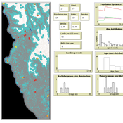
Peer reviewed BHSPopDy (Bighorn sheep population dynamics)
Aniruddha Belsare Ryan Long E Frances Cassirer | Published Tuesday, November 05, 2019This is an agent-based model coded in NetLogo. The model simulates population dynamics of bighorn sheep population in the Hell’s Canyon region of Idaho and will be used to develop a better understanding of pneumonia dynamics in bighorn sheep populations. The overarching objective is to provide a decision-making context for effective management of pneumonia in wild populations of bighorn sheep.
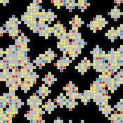
The PARSO_demo Model
Davide Secchi | Published Tuesday, November 05, 2019This model explores different aspects of the formation of urban neighbourhoods where residents believe in values distant from those dominant in society. Or, at least, this is what the Danish government beliefs when they discuss their politics about parallel societies. This simulation is set to understand (a) whether these alternative values areas form and what determines their formation, (b) if they are linked to low or no income residents, and (c) what happens if they disappear from the map. All these three points are part of the Danish government policy. This agent-based model is set to understand the boundaries and effects of this policy.
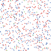
The Hawk-Dove Game
Kristin Crouse | Published Tuesday, November 05, 2019This model simulates the Hawk-Dove game as first described by John Maynard Smith, and further elaborated by Richard Dawkins in “The Selfish Gene”. In the game, two strategies, Hawks and Doves, compete against each other, and themselves, for reproductive benefits. A third strategy can be introduced, Retaliators, which act like either Hawks or Doves, depending on the context.
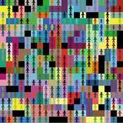
Fertility Tradeoffs
Kristin Crouse | Published Tuesday, November 05, 2019 | Last modified Thursday, April 06, 2023Fertility Tradeoffs is a NetLogo model that illustrates the emergencent tradeoffs between the quality and quantity of offspring. Often, we associate high fitness with maximizing the number of offspring. However, under certain circumstances, it pays instead to optimize the number of offspring, having fewer offspring than is possible. When the number of offspring is reduced, more energy can be invested in each offspring, which can have fitness benefits.
A network agent-based model of ethnocentrism and intergroup cooperation
Ross Gore | Published Sunday, October 27, 2019We present a network agent-based model of ethnocentrism and intergroup cooperation in which agents from two groups (majority and minority) change their communality (feeling of group solidarity), cooperation strategy and social ties, depending on a barrier of “likeness” (affinity). Our purpose was to study the model’s capability for describing how the mechanisms of preexisting markers (or “tags”) that can work as cues for inducing in-group bias, imitation, and reaction to non-cooperating agents, lead to ethnocentrism or intergroup cooperation and influence the formation of the network of mixed ties between agents of different groups. We explored the model’s behavior via four experiments in which we studied the combined effects of “likeness,” relative size of the minority group, degree of connectivity of the social network, game difficulty (strength) and relative frequencies of strategy revision and structural adaptation. The parameters that have a stronger influence on the emerging dominant strategies and the formation of mixed ties in the social network are the group-tag barrier, the frequency with which agents react to adverse partners, and the game difficulty. The relative size of the minority group also plays a role in increasing the percentage of mixed ties in the social network. This is consistent with the intergroup ties being dependent on the “arena” of contact (with progressively stronger barriers from e.g. workmates to close relatives), and with measures that hinder intergroup contact also hindering mutual cooperation.
NetLogo HIV spread model
Wouter Vermeer | Published Friday, October 25, 2019This model describes the tranmission of HIV by means of unprotected anal intercourse in a population of men-who-have-sex-with-men.
The model is parameterized based on field data from a cohort study conducted in Atlanta Georgia.
Peer reviewed An extended replication of Abelson's and Bernstein's community referendum simulation
Klaus G. Troitzsch | Published Friday, October 25, 2019 | Last modified Friday, August 25, 2023This is an extended replication of Abelson’s and Bernstein’s early computer simulation model of community referendum controversies which was originally published in 1963 and often cited, but seldom analysed in detail. This replication is in NetLogo 6.3.0, accompanied with an ODD+D protocol and class and sequence diagrams.
This replication replaces the original scales for attitude position and interest in the referendum issue which were distributed between 0 and 1 with values that are initialised according to a normal distribution with mean 0 and variance 1 to make simulation results easier compatible with scales derived from empirical data collected in surveys such as the European Value Study which often are derived via factor analysis or principal component analysis from the answers to sets of questions.
Another difference is that this model is not only run for Abelson’s and Bernstein’s ten week referendum campaign but for an arbitrary time in order that one can find out whether the distributions of attitude position and interest in the (still one-dimensional) issue stabilise in the long run.
Spatio-Temporal Dynamic of Risk Model
J Jumadi | Published Tuesday, October 22, 2019 | Last modified Sunday, January 05, 2020This model aims to simlulate the dynamic of risk over time and space.
An agent-based model to simulate meat consumption behaviour of consumers in Britain
Andrea Scalco | Published Friday, October 18, 2019The current rate of production and consumption of meat poses a problem both to peoples’ health and to the environment. This work aims to develop a simulation of peoples’ meat consumption behaviour in Britain using agent-based modelling. The agents represent individual consumers. The key variables that characterise agents include sex, age, monthly income, perception of the living cost, and concerns about the impact of meat on the environment, health, and animal welfare. A process of peer influence is modelled with respect to the agents’ concerns. Influence spreads across two eating networks (i.e. co-workers and household members) depending on the time of day, day of the week, and agents’ employment status. Data from a representative sample of British consumers is used to empirically ground the model. Different experiments are run simulating interventions of application of social marketing campaigns and a rise in price of meat. The main outcome is the average weekly consumption of meat per consumer. A secondary outcome is the likelihood of eating meat.
Sharing economy in the short-time accommodations market
Bruna Bruno Marisa Faggini | Published Wednesday, October 16, 2019We present an agent-based model for the sharing economy, in the short-time accommodations market, where peers participating as suppliers and demanders follow simple decision rules about sharing market participation, according to their heterogeneous characteristics. We consider the sharing economy mainly as a peer-to-peer market where the access is preferred to ownership, excluding professional agents using sharing platforms as Airbnb to promote their business.
Displaying 10 of 1253 results
