About the CoMSES Model Library more info
Our mission is to help computational modelers develop, document, and share their computational models in accordance with community standards and good open science and software engineering practices. Model authors can publish their model source code in the Computational Model Library with narrative documentation as well as metadata that supports open science and emerging norms that facilitate software citation, computational reproducibility / frictionless reuse, and interoperability. Model authors can also request private peer review of their computational models. Models that pass peer review receive a DOI once published.
All users of models published in the library must cite model authors when they use and benefit from their code.
Please check out our model publishing tutorial and feel free to contact us if you have any questions or concerns about publishing your model(s) in the Computational Model Library.
We also maintain a curated database of over 7500 publications of agent-based and individual based models with detailed metadata on availability of code and bibliometric information on the landscape of ABM/IBM publications that we welcome you to explore.
Displaying 10 of 260 results for "Ted C. Rogers" clear search
Hybrid fish-plankton model
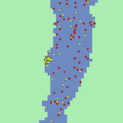
Gudrun Wallentin Christian Neuwirth | Published Friday, October 28, 2016 | Last modified Sunday, January 29, 2017A hybrid predator-prey model of fish and plankton that switches dynamically between ABM and SD representations. It contains 6 related structural designs of the same model.
Exploring the Effects of Link Recommendations on Social Networks
Andrew Crooks Ciara Sibley | Published Thursday, March 19, 2020The purpose of this model is explore how “friend-of-friend” link recommendations, which are commonly used on social networking sites, impact online social network structure. Specifically, this model generates online social networks, by connecting individuals based upon varying proportions of a) connections from the real world and b) link recommendations. Links formed by recommendation mimic mutual connection, or friend-of-friend algorithms. Generated networks can then be analyzed, by the included scripts, to assess the influence that different proportions of link recommendations have on network properties, specifically: clustering, modularity, path length, eccentricity, diameter, and degree distribution.
A network agent-based model of ethnocentrism and intergroup cooperation
Ross Gore | Published Sunday, October 27, 2019We present a network agent-based model of ethnocentrism and intergroup cooperation in which agents from two groups (majority and minority) change their communality (feeling of group solidarity), cooperation strategy and social ties, depending on a barrier of “likeness” (affinity). Our purpose was to study the model’s capability for describing how the mechanisms of preexisting markers (or “tags”) that can work as cues for inducing in-group bias, imitation, and reaction to non-cooperating agents, lead to ethnocentrism or intergroup cooperation and influence the formation of the network of mixed ties between agents of different groups. We explored the model’s behavior via four experiments in which we studied the combined effects of “likeness,” relative size of the minority group, degree of connectivity of the social network, game difficulty (strength) and relative frequencies of strategy revision and structural adaptation. The parameters that have a stronger influence on the emerging dominant strategies and the formation of mixed ties in the social network are the group-tag barrier, the frequency with which agents react to adverse partners, and the game difficulty. The relative size of the minority group also plays a role in increasing the percentage of mixed ties in the social network. This is consistent with the intergroup ties being dependent on the “arena” of contact (with progressively stronger barriers from e.g. workmates to close relatives), and with measures that hinder intergroup contact also hindering mutual cooperation.
Hollywood Underrepresentation Simulated Causes
Carmen Iasiello | Published Sunday, November 26, 2023Presented here is a socioeconomic agent-based model (ABM) to examine the Hollywood labor system as a network within a simulated movie labor market based on preferential attachment and compare the findings with 50 co-production ego networks during the 2015 movie year. Using the ABM, I test the role slight individual preference for racial and ethnic similarity within one’s own network at the microlevel and find that it is insufficient to explain the phenomena of racial and ethnic underrepresentation at the macrolevel. The ABM also includes the ability to test alternative explanations, such as overt opportunity loss as a possible explanation.
Walk Away in groups
Athena Aktipis | Published Thursday, March 17, 2016This NetLogo model implements the Walk Away strategy in a spatial public goods game, where individuals have the ability to leave groups with insufficient levels of cooperation.
Segregation and Opinion Polarization
Thomas Feliciani Andreas Flache Jochem Tolsma | Published Wednesday, April 13, 2016This is a tool to explore the effects of groups´ spatial segregation on the emergence of opinion polarization. It embeds two opinion formation models: a model of negative (and positive) social influence and a model of persuasive argument exchange.
Peer reviewed Viable North Sea (ViNoS): A NetLogo Agent-based Model of German Small-scale Fisheries
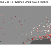
Wolfgang Nikolaus Probst Jieun Seo Jürgen Scheffran Carsten Lemmen Sascha Hokamp Verena Mühlberger Serra Örey | Published Thursday, May 25, 2023 | Last modified Tuesday, December 05, 2023Viable North Sea (ViNoS) is an Agent-based Model of the German North Sea Small-scale Fisheries in a Social-Ecological Systems framework focussing on the adaptive behaviour of fishers facing regulatory, economic, and resource changes. Small-scale fisheries are an important part both of the cultural perception of the German North Sea coast and of its fishing industry. These fisheries are typically family-run operations that use smaller boats and traditional fishing methods to catch a variety of bottom-dwelling species, including plaice, sole, and brown shrimp. Fisheries in the North Sea face area competition with other uses of the sea – long practiced ones like shipping, gas exploration and sand extractions, and currently increasing ones like marine protection and offshore wind farming. German authorities have just released a new maritime spatial plan implementing the need for 30% of protection areas demanded by the United Nations High Seas Treaty and aiming at up to 70 GW of offshore wind power generation by 2045. Fisheries in the North Sea also have to adjust to the northward migration of their established resources following the climate heating of the water. And they have to re-evaluate their economic balance by figuring in the foreseeable rise in oil price and the need for re-investing into their aged fleet.
BEGET Classic
Kristin Crouse | Published Monday, November 11, 2019 | Last modified Monday, November 25, 2019BEGET Classic includes previous versions used in the classroom and for publication. Please check out the latest version of B3GET here, which has several user-friendly features such as directly importing and exporting genotype and population files.
The classic versions of B3GET include: version one and version three were used in undergraduate labs at the University of Minnesota to demonstrate principles in primate behavioral ecology; version two first demonstrated proof of concept for creating virtual biological organisms using decision-vector algorithms; version four was presented at the 2017 annual meeting at the American Association of Physical Anthropologists; version five was presented in a 2019 publication from the Journal of Human Evolution (Crouse, Miller, and Wilson, 2019).
Peer reviewed B3GET
Kristin Crouse | Published Thursday, November 14, 2019 | Last modified Tuesday, September 20, 2022B3GET simulates populations of virtual organisms evolving over generations, whose evolutionary outcomes reflect the selection pressures of their environment. The model simulates several factors considered important in biology, including life history trade-offs, investment in fighting ability and aggression, sperm competition, infanticide, and competition over access to food and mates. Downloaded materials include starting genotype and population files. Edit the these files and see what changes occur in the behavior of virtual populations!
View the B3GET user manual here.
Peer reviewed ABM to create populations with realistic Big Five Personality Trait Expressions
Michael Vogrin | Published Tuesday, May 30, 2023This model aims at creating agent populations that have “personalities”, as described by the Big Five Model of Personality. The expression of the Big Five in the agent population has the following properties, so that they resemble real life populations as closely as possible:
-The population mean of each trait is 0.5 on a scale from 0 to 1.
-The population-wide distribution of each trait approximates a normal distribution.
-The intercorrelations of the Big Five are close to those observed in the Literature.
The literature used to fit the model was a publication by Dimitri van der Linden, Jan te Nijenhuis, and Arnold B. Bakker:
…
Displaying 10 of 260 results for "Ted C. Rogers" clear search


