About the CoMSES Model Library more info
Our mission is to help computational modelers develop, document, and share their computational models in accordance with community standards and good open science and software engineering practices. Model authors can publish their model source code in the Computational Model Library with narrative documentation as well as metadata that supports open science and emerging norms that facilitate software citation, computational reproducibility / frictionless reuse, and interoperability. Model authors can also request private peer review of their computational models. Models that pass peer review receive a DOI once published.
All users of models published in the library must cite model authors when they use and benefit from their code.
Please check out our model publishing tutorial and feel free to contact us if you have any questions or concerns about publishing your model(s) in the Computational Model Library.
We also maintain a curated database of over 7500 publications of agent-based and individual based models with detailed metadata on availability of code and bibliometric information on the landscape of ABM/IBM publications that we welcome you to explore.
Displaying 10 of 225 results for "Abi Vanak" clear search
Survival analysis and Population viability analysis of the Northern Bald Ibis
Stephanie Kramer-Schadt Cédric Scherer Viktoriia Radchuk Sinah Drenske Corinna Esterer Ingo Kowarik Johannes Fritz | Published Thursday, August 04, 2022This is the full repository to run the survival analysis (in R) and run the population viability model and its analysis (NetLogo + R) of the Northern Bald Ibis (NBI) presented in the study
On the road to self-sustainability: Reintroduced migratory European Northern Bald Ibises (Geronticus eremita) still need management interventions for population viability
by Sinah Drenske, Viktoriia Radchuk, Cédric Scherer, Corinna Esterer, Ingo Kowarik, Johannes Fritz, Stephanie Kramer-Schadt
…
Peer reviewed HUMLAND FIRE-IN-THE-HOLE agent-based model
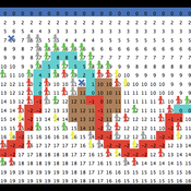
Fulco Scherjon Anastasia Nikulina | Published Monday, October 20, 2025HUMLAND Fire-in-the-Hole is a conceptual agent-based model (ABM) designed to explore the ecological and behavioral consequences of fire-driven hunting strategies employed by hunter-gatherers, specifically Neanderthals, during the Last Interglacial period around the Neumark-Nord (Germany) archaeological site.
This model builds on and specializes the HUMLAND 1.0.0 model (Nikulina et al. 2024), integrating anthropogenic fires, elephant group behavior, and landscape response to simulate interactions between humans, megafauna, and vegetation over time.
Peer reviewed The dynamical relationship between individual needs and group performance: A simulation of the self-organising task allocation process
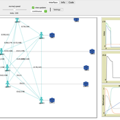
Shaoni Wang | Published Tuesday, October 05, 2021The purpose of the model is to study the dynamical relationship between individual needs and group performance when focusing on self-organizing task allocation. For this, we develop a model that formalizes Deci & Ryan’s self-determination theory (SDT) theory into an ABM creating a framework to study the social dynamics that pertain to the mutual relations between the individual and group level of team performance. Specifically, it aims to answer how the three individual motivations of autonomy, competence, and belonging affect team performance.
Peer reviewed A model of environmental awareness spread and its effect in resource consumption reduction
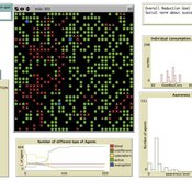
Giovanna Sissa | Published Sunday, June 21, 2015 | Last modified Monday, August 17, 2015The model reproduces the spread of environmental awareness among agents and the impact of awareness level of the agents on the consumption of a resource, like energy. An agent is a household with a set of available advanced smart metering functions.
Peer reviewed ELTAP-Egy model (Energy Landscape Transition Analysis and Planning in Egypt)
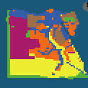
Mostafa Shaaban Jürgen Scheffran Jürgen Böhner Mohamed Salah Elsobki | Published Saturday, December 29, 2018The model investigates conditions, scenarios and strategies for future planning of energy in Egypt, with an emphasis on alternative energy pathways and a sustainable electricity supply mix as part of an energy roadmap till the year 2100. It combines the multi-criteria decision analysis (MCDA) with agent-based modeling (ABM) and Geographic Information Systems (GIS) visualization to integrate the interactions of the decisions of multi-agents, the multi-criteria evaluation of sustainability, the time factor and the site factors to assess the transformation of energy landscapes.
epiworldR Type: Fast Agent-Based Epi Models
George G. Vega Yon Derek Meyer | Published Monday, August 26, 2024A flexible framework for Agent-Based Models (ABM), the ‘epiworldR’ package provides methods for prototyping disease outbreaks and transmission models using a ‘C++’ backend, making it very fast. It supports multiple epidemiological models, including the Susceptible-Infected-Susceptible (SIS), Susceptible-Infected-Removed (SIR), Susceptible-Exposed-Infected-Removed (SEIR), and others, involving arbitrary mitigation policies and multiple-disease models. Users can specify infectiousness/susceptibility rates as a function of agents’ features, providing great complexity for the model dynamics. Furthermore, ‘epiworldR’ is ideal for simulation studies featuring large populations.
Agent-Based Model of a Circular Food Packaging Ecosystem to assess Packaging Waste Dynamics
Annoek Reitsema | Published Friday, October 11, 2024Reducing packaging waste is a critical challenge that requires organizations to collaborate within circular ecosystems, considering social, economic, and technical variables like decision-making behavior, material prices, and available technologies. Agent-Based Modeling (ABM) offers a valuable methodology for understanding these complex dynamics. In our research, we have developed an ABM to explore circular ecosystems’ potential in reducing packaging waste, using a case study of the Dutch food packaging ecosystem. The model incorporates three types of agents—beverage producers, packaging producers, and waste treaters—who can form closed-loop recycling systems.
Beverage Producer Agents: These agents represent the beverage company divided into five types based on packaging formats: cans, PET bottles, glass bottles, cartons, and bag-in-boxes. Each producer has specific packaging demands based on product volume, type, weight, and reuse potential. They select packaging suppliers annually, guided by deterministic decision styles: bargaining (seeking the lowest price) or problem-solving (prioritizing high recycled content).
Packaging Producer Agents: These agents are responsible for creating packaging using either recycled or virgin materials. The model assumes a mix of monopolistic and competitive market situations, with agents calculating annual material needs. Decision styles influence their choices: bargaining agents compare recycled and virgin material costs, while problem-solving agents prioritize maximum recycled content. They calculate recycled content in packaging and set prices accordingly, ensuring all produced packaging is sold within or outside the model.
…
FlowLogo: An agent-based platform for simulating complex human-aquifer interactions in managed groundwater systems
Juan Castilla-Rho | Published Sunday, August 30, 2015FlowLogo integrates agent-based and groundwater flow simulation. It aims to simplify the process of developing participatory ABMs in the groundwater space and begin the exploration of novel, bottom-up solutions to conflicts in shared aquifers.
Simulation model for compliance behaviour
Esther Van Asselt Sjoukje A Osinga | Published Friday, October 03, 2014 | Last modified Tuesday, December 08, 2015This model can be used to optimize intervention strategies for inspection services.
MedLanD Modeling Laboratory
C Michael Barton Sean Bergin Isaac Ullah Gary Mayer Hessam Sarjoughian Helena Mitasova | Published Friday, May 08, 2015 | Last modified Thursday, December 14, 2017The MML is a hybrid modeling environment that couples an agent-based model of small-holder agropastoral households and a cellular landscape evolution model that simulates changes in erosion/deposition, soils, and vegetation.
Displaying 10 of 225 results for "Abi Vanak" clear search

