Our mission is to help computational modelers develop, document, and share their computational models in accordance with community standards and good open science and software engineering practices. Model authors can publish their model source code in the Computational Model Library with narrative documentation as well as metadata that supports open science and emerging norms that facilitate software citation, computational reproducibility / frictionless reuse, and interoperability. Model authors can also request private peer review of their computational models. Models that pass peer review receive a DOI once published.
All users of models published in the library must cite model authors when they use and benefit from their code.
Please check out our model publishing tutorial and feel free to contact us if you have any questions or concerns about publishing your model(s) in the Computational Model Library.
Displaying 10 of 1141 results for "Bin-Tzong Chi" clear search
MoPAgrIB: simulating savannah landscape mosaic under shifting cultivation
Nicolas Becu Marc Deconchat Eric Garine Kouami Kokou Christine Raimond | Published Monday, May 27, 2013 | Last modified Tuesday, January 21, 2014MoPAgrIB model simulates the movement of cultivated patches in a savannah vegetation mosaic ; how they move and relocate through the landscape, depending on farming practices, population growth, social rules and vegetation growth.
The model implements a model that reflects features of a rural hill village in Nepal. Key features of the model include water storage, social capital and migration of household members who then send remittances back to the village.
Agent-based Simulation Models of the College Sorting Process
Rachel Baker Sean F Reardon Matt Kasman Daniel Klasik | Published Friday, May 23, 2014We explore how dynamic processes related to socioeconomic inequality operate to sort students into, and create stratification among, colleges.
Interplay of actors about the construction of a dam
Christophe Sibertin-Blanc | Published Monday, December 05, 2016 | Last modified Wednesday, May 09, 2018Model of a very serious conflict about the relevance of a dam to impede its construction, between the client, the prime contractor, State, legalist opponents and activist opponents.
LBD Model: Learning-by-doing for sustainable management of renewable resources
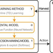
Emilie Lindkvist Örjan Ekeberg Jon Norberg | Published Thursday, March 09, 2017This is a simulation model of an intelligent agent that has the objective to learn sustainable management of a renewable resource, such as a fish stock.
ABM Household Decision Making on Solar Energy using Theory of Planned Behaviour
Tatiana Filatova Hannah Muelder | Published Tuesday, May 21, 2019The model aims at estimating household energy consumption and the related greenhouse gas (GHG) emissions reduction based on the behavior of the individual household under different operationalizations of the Theory of Planned Behaviour (TPB).
The original model is developed as a tool to explore households decisions regarding solar panel investments and cumulative consequences of these individual choices (i.e. diffusion of PVs, regional emissions savings, monetary savings). We extend the model to explore a methodological question regarding an interpretation of qualitative concepts from social science theories, specifically Theory of Planned Behaviour in a formal code of quantitative agent-based models (ABMs). We develop 3 versions of the model: one TPB-based ABM designed by the authors and two alternatives inspired by the TPB-ABM of Schwarz and Ernst (2009) and the TPB-ABM of Rai and Robinson (2015). The model is implemented in NetLogo.
This model presents an autonomous, two-lane driving environment with a single lane-closure that can be toggled. The four driving scenarios - two baseline cases (based on the real-world) and two experimental setups - are as follows:
- Baseline-1 is where cars are not informed of the lane closure.
- Baseline-2 is where a Red Zone is marked wherein cars are informed of the lane closure ahead.
- Strategy-1 is where cars use a co-operative driving strategy - FAS. <sup>[1]</sup>
- Strategy-2 is a variant of Strategy-1 and uses comfortable deceleration values instead of the vehicle’s limit.
…
Holmestrand School Model
Jessica Dimka | Published Friday, June 18, 2021 | Last modified Friday, April 29, 2022The Holmestrand model is an epidemiological agent-based model. Its aim is to test hypotheses related to how the social and physical environment of a residential school for children with disabilities might influence the spread of an infectious disease epidemic among students and staff. Annual reports for the Holmestrand School for the Deaf (Norway) are the primary sources of inspiration for the modeled school, with additional insights drawn from other archival records for schools for children with disabilities in early 20th century Norway and data sources for the 1918 influenza pandemic. The model environment consists of a simplified boarding school that includes residential spaces for students and staff, classrooms, a dining room, common room, and an outdoor area. Students and staff engage in activities reflecting hourly schedules suggested by school reports. By default, a random staff member is selected as the first case and is infected with disease. Subsequent transmission is determined by agent movement and interactions between susceptible and infectious pairs.
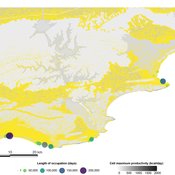
PaleoscapeABM: coastal occupation and shellfish discard
Claudine Gravel-Miguel | Published Tuesday, February 08, 2022This model builds on the Armature distribution within the PaleoscapeABM model, which is itself a variant of the PaleoscapeABM available here written by Wren and Janssen, and.
This model aims to explore where and how much shellfish is discarded at coastal and non-coastal locations by daily coastal foraging. We use this model’s output to test the idea that we can confidently use the archaeological record to evaluate the importance of shellfish in prehistoric people’s diets.
The recognition that aquatic adaptations likely had significant impacts on human evolution triggered an explosion of research on that topic. Recognizing coastal foraging in the past relies on the archaeological signature of that behavior. We use this model to explore why some coastal sites are very intensely occupied and see if it is due to the shellfish productivity of the coast.
Household Energy Retrofit Behavior (HERB) ABM
Lars Even Egner | Published Thursday, October 20, 2022The HERB model simulates the retrofit behavior of homeowners in a neighborhood. The model initially parameterizes a neighborhood and households with technical factors such as energy standard, the availability of subsidies, and neighbors’ retrofit activity. Then, these factors are translated into psychological variables such as perceived comfort gain, worry about affording the retrofit, and perceiving the current energy standard of the home as wasteful. These psychological variables moderate the transition between four different stages of deciding to retrofit, as suggested by a behavioral model specific to household energy retrofitting identified based on a large population survey in Norway. The transition between all stages eventually leads to retrofitting, which affects both the household’s technical factors and friends and neighbors, bringing the model “full circle”. The model assumes that the energy standard of the buildings deteriorates over time, forcing households to retrofit regularly to maintain a certain energy standard.
Because experiment datafiles are about 15GB, they are available at https://doi.org/10.18710/XOSAMD
Displaying 10 of 1141 results for "Bin-Tzong Chi" clear search