About the CoMSES Model Library more info
Our mission is to help computational modelers develop, document, and share their computational models in accordance with community standards and good open science and software engineering practices. Model authors can publish their model source code in the Computational Model Library with narrative documentation as well as metadata that supports open science and emerging norms that facilitate software citation, computational reproducibility / frictionless reuse, and interoperability. Model authors can also request private peer review of their computational models. Models that pass peer review receive a DOI once published.
All users of models published in the library must cite model authors when they use and benefit from their code.
Please check out our model publishing tutorial and feel free to contact us if you have any questions or concerns about publishing your model(s) in the Computational Model Library.
We also maintain a curated database of over 7500 publications of agent-based and individual based models with detailed metadata on availability of code and bibliometric information on the landscape of ABM/IBM publications that we welcome you to explore.
Displaying 10 of 965 results for "Dave van Wees" clear search
Irrigation game
Marco Janssen | Published Monday, July 23, 2012 | Last modified Saturday, April 27, 2013Irrigation game calibrated on experimental data
The purpose of this model is to enhance a basic ABM through a simple set of rules identified using the activity-driven models in order to produce more realistic patterns of pedestrian movement.
Carington
William Kennedy Emily S Ihara Catherine J Tompkins Michael E Wolf-Branigin | Published Thursday, July 13, 2017The Carington model is designed to provide insights into the factors affecting informal health care for older adults. It encompasses older adults, caregivers, and factors affecting informal health care. The Carington model includes no submodels.
The Social Neighbourhood Model
Igor Nikolic Geertje Slingerland | Published Wednesday, February 01, 2023An agent-based model that simulates urban neighbourhoods. The model has been designed to simulate perceived livability and safety (PLS) of citizens. The score attached to perceived livability and safety, PLS, is the main output of the model and is the average of each individual’s PLS. These PLS scores, in turn, are specific to each citizen and highly dependent on their individual experiences. PLS is impacted by several different social factors: interactions with fellow citizens, police officers, and community workers; visiting or starting a neighbourhood initiative; experiencing a burglary; seeing a youth gang; or hearing from friends (of friends) about these events. On top of this, the model allows to set various types of social networks which also influence the PLS.
Scientific disagreements and the diagnosticity of evidence
Matteo Michelini | Published Wednesday, December 13, 2023The present model is an abstract ABM designed for theoretical exploration and hypotheses generation. Its main aim is to explore the relationship between disagreement over the diagnostic value of evidence and the formation of polarization in scientific communities.
The model represents a scientific community in which scientists aim to determine whether hypothesis H is true, and we assume that agents are in a world in which H is indeed true. To this end, scientists perform experiments, interpret data and exchange their views on how diagnostic of H the obtained evidence is. Based on how the scientists conduct the inquiry, the community may reach a correct consensus (i.e. a situation in which every scientist agrees that H is correct) or not.
Status hierarchies and the emergence of cooperation in task groups
Hsuan-Wei Lee | Published Thursday, January 02, 2025This repository contains an agent-based simulation model exploring how status hierarchies influence the emergence and sustainability of cooperation in task-oriented groups. The model builds on evolutionary game theory to examine the dynamics of cooperation under single-leader and multi-leader hierarchies, investigating factors such as group size, assortativity, and hierarchical clarity. Key findings highlight the trade-offs between different leadership structures in fostering group cooperation and reveal the conditions under which cooperation is most stable.
The repository includes code for simulations, numerical analysis scripts, and visualization tools to replicate the results presented in the manuscript titled “Status hierarchies and the emergence of cooperation in task groups.”
Feel free to explore, reproduce the findings, or adapt the model for further research!
“Food for all” (FFD)
Andreas Angourakis José Manuel Galán Andrea L Balbo José Santos | Published Friday, April 25, 2014 | Last modified Monday, April 08, 2019“Food for all” (FFD) is an agent-based model designed to study the evolution of cooperation for food storage. Households face the social dilemma of whether to store food in a corporate stock or to keep it in a private stock.
The Coevolution of the Firm and the Product Attribute Space
César García-Díaz | Published Friday, May 22, 2020This model inspects the performance of firms as the product attribute space changes, which evolves as a consequence of firms’ actions. Firms may create new product variants by dragging demand from other existing variants. Firms decide whether to open new product variants, to invade existing ones, or to keep their variant portfolio. At each variant there is a Cournot competition each round. Competition is nested since many firms compete at many variants simultaneously, affecting firm composition at each location (variant).
After the Cournot outcomes, at each round firms decide whether to (i) keep their existing product variant niche, (ii) invade an existing variant, (iii) create a new variant, or (iv) abandon a variant. Firms’ profits across their niche take into consideration the niche-width cost and the cost of opening a new variant.
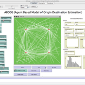
ABODE - Agent Based Model of Origin Destination Estimation
D Levinson | Published Monday, August 29, 2011 | Last modified Saturday, April 27, 2013The agent based model matches origins and destinations using employment search methods at the individual level.
Finance and Market Concentration Using Agent-Based Modeling: Evidence from South Korea
Yunkyeong Seo Zeynep Elif Altiner Sumin Lee Ilchul Moon Taesub Yun | Published Friday, March 28, 2025Amidst the global trend of increasing market concentration, this paper examines the role of finance
in shaping it. Using Agent-Based Modeling (ABM), we analyze the impact of financial policies on market concentration
and its closely related variables: economic growth and labor income share. We extend the Keynes
meets Schumpeter (K+S) model by incorporating two critical assumptions that influence market concentration.
Policy experiments are conducted with a model validated against historical trends in South Korea. For policy
variables, the Debt-to-Sales Ratio (DSR) limit and interest rate are used as levers to regulate the quantity and
…
Displaying 10 of 965 results for "Dave van Wees" clear search
