Our mission is to help computational modelers develop, document, and share their computational models in accordance with community standards and good open science and software engineering practices. Model authors can publish their model source code in the Computational Model Library with narrative documentation as well as metadata that supports open science and emerging norms that facilitate software citation, computational reproducibility / frictionless reuse, and interoperability. Model authors can also request private peer review of their computational models. Models that pass peer review receive a DOI once published.
All users of models published in the library must cite model authors when they use and benefit from their code.
Please check out our model publishing tutorial and feel free to contact us if you have any questions or concerns about publishing your model(s) in the Computational Model Library.
Displaying 10 of 825 results NetLogo clear search
Peer reviewed Mission Cattle
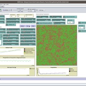
Isaac Ullah | Published Monday, December 15, 2025The model examines cattle herd dynamics on a patchy grassland subject to two exogenous pressures: periodic raiding events that remove animals and scheduled management culling that can target males and/or females. It is intended for comparative experiments on how raiding frequency, culling schedules, vegetation dynamics, and life-history parameters interact to shape herd persistence. The model was specifically designed to test the scenario of cattle herding in the arid grasslands of southern Arizona and northern Sonora during the mission period (late 17th through late 18th centuries, CE). In this period, herds were locally managed by Spanish mission personnel and local O’odham groups. Herds were culled mostly for local consumption of meat, hides, and tallow, but the mission herds were often targets for raiding by neighboring groups. The main purpose of the model is to examine herd dynamics in a seasonally variable, arid environment where herds are subject to both intentional internal harvest (culling) and external harvest (raiding).
Geospatial Agent-Based Model of Immigrant Settlement Dynamics in Metro Vancouver
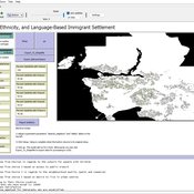
Liliana Perez Navid Mahdizadeh Gharakhanlou Maryam Yousefi | Published Wednesday, December 03, 2025This agent-based model simulates how new immigrant households choose where to live in Metro Vancouver under the origins diversity scenario. The model begins with 16,000 household agents, reflecting an expected annual population increase of about 42,500 people based on an average household size of 2.56. Each agent is assigned four characteristics: one of ten origin categories, income level (adjusted using NOC data and recent immigrant earnings), likelihood of having children, and preferred mode of commuting. The ten origin groups are drawn from Census patterns, including six subgroups within the broader Asian category (China, India, the Philippines, Iran, South Korea, and Other Asian countries) and two categories for immigrants from the Americas. This refined classification better captures the diversity of newcomers arriving in the region.
Agent-based Modelling of Unsustainable and Sustainable Norms Under Resource Constraints
Fachrizal Sinaga Adrian Thomas Sufyan Fawwad | Published Monday, November 24, 2025This model explores the coupled dynamics of social norm diffusion and finite resource depletion. Extending the “Affordance Landscape” framework by Kaaronen & Strelkovskii (2020), this simulation investigates how resource scarcity and regeneration rates influence the adoption of pro-environmental behaviours.
The model addresses the gap by linking behavioural norms to a depleting common-pool resource. It tests whether sustainable norms can diffuse rapidly enough to prevent ecological collapse and identifies “tipping points” where resource scarcity acts as a driver for behavioural change.
FRAMe (Flood Resilience Agent-Based Model)
Wenhan Feng | Published Wednesday, October 22, 2025The FRAMe (Flood Resilience Agent-Based Model) serves as a framework designed to simulate flood resilience dynamics at the community level, focusing on a rural settlement in the Mekong River Basin. Integrating empirical data from extensive surveys, Bayesian networks, and hydrological simulations, the framework quantifies resilience as a trade-off between robustness (resistance to damage) and adaptability (capacity for dynamic response). Agents include households, governments, and other actors, linked by social and governance networks that facilitate knowledge transfer, resource distribution, and risk communication. FRAMe incorporates mechanisms for flood forecasting, policy interventions (education, aid, insurance), and individual and collective decision-making, grounded in Protection Motivation Theory and MoHuB frameworks. The framework’s spatially explicit design leverages GIS data, which supports scenario testing of governance structures and stakeholder interactions. By examining policy scenarios and agent behavior, FRAMe aims to inform adaptive flood management strategies and enhance community resilience.
Peer reviewed HUMLAND FIRE-IN-THE-HOLE agent-based model
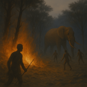
Fulco Scherjon Anastasia Nikulina | Published Monday, October 20, 2025HUMLAND Fire-in-the-Hole is a conceptual agent-based model (ABM) designed to explore the ecological and behavioral consequences of fire-driven hunting strategies employed by hunter-gatherers, specifically Neanderthals, during the Last Interglacial period around the Neumark-Nord (Germany) archaeological site.
This model builds on and specializes the HUMLAND 1.0.0 model (Nikulina et al. 2024), integrating anthropogenic fires, elephant group behavior, and landscape response to simulate interactions between humans, megafauna, and vegetation over time.
Peer reviewed MicroAnts 2.5
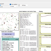
Diogo Alves | Published Thursday, October 16, 2025MicroAnts 2.5 is a general-purpose agent-based model designed as a flexible workhorse for simulating ecological and evolutionary dynamics in artificial populations, as well as, potentially, the emergence of political institutions and economic regimes. It builds on and extends Stephen Wright’s original MicroAnts 2.0 by introducing configurable predators, inequality tracking, and other options.
Ant agents are of two tyes/casts and controlled by 16-bit chromosomes encoding traits such as vision, movement, mating thresholds, sensing, and combat strength. Predators (anteaters) operate in static, random, or targeted predatory modes. Ants reproduce, mutate, cooperate, fight, and die based on their traits and interactions. Environmental pressures (poison and predators) and social dynamics (sharing, mating, combat) drive emergent behavior across red and black ant populations.
The model supports insertion of custom agents at runtime, configurable mutation/inversion rates, and exports detailed statistics, including inequality metrics (e.g., Gini coefficients), trait frequencies, predator kills, and lineage data. Intended for rapid testing and educational experimentation, MicroAnts 2.5 serves as a modular base for more complex ecological and social simulations.
Incentives for data sharing
Flaminio Squazzoni Federico Bianchi Thomas Klebel Tony Ross-Hellauer | Published Thursday, October 02, 2025Although beneficial to scientific development, data sharing is still uncommon in many research areas. Various organisations, including funding agencies that endorse open science, aim to increase its uptake. However, estimating the large-scale implications of different policy interventions on data sharing by funding agencies, especially in the context of intense competition among academics, is difficult empirically. Here, we built an agent-based model to simulate the effect of different funding schemes (i.e., highly competitive large grants vs. distributive small grants), and varying intensity of incentives for data sharing on the uptake of data sharing by academic teams strategically adapting to the context.
Industrial Cooperation and the Hydrogen Transition
Amineh Ghorbani Renske van 't Veer Emre Ates Zofia Lukszo | Published Tuesday, September 23, 2025An Agent Based Model that explores the deployment of hydrogen among a regional industrial cluster in the Netherlands, consisting of 15 companies. The companies seek to decarbonize by replacing their natural gas by hydrogen.
The model integrates technical characteristics as well as company motivations to transition to hydrogen. The baseline model only considers individual investments where company can locally produce hydrogen. If they reach the backbone threshold, companies can also consider buying hydrogen through a connection to the national hydrogen network. The second scenario considers that companies can participate in a joint investment to get an electrolyzer to locally produce the hydrogen.
Two experiments look at the impact of the sectoral configuration and at the impact of subsidy conditions on the region’s hydrogen transition
Netlogo model ` Effect of Network Homophily and Partisanship on Social Media to “Oil Spill” Polarizations’
takuya nagura | Published Saturday, September 13, 2025This model was utilized for the simulation in the paper titled Effect of Network Homophily and Partisanship on Social Media to “Oil Spill” Polarizations. It allows you to examine whether oil spill polarization occurs through people’s communication under various conditions.
・Choose the network construction conditions you’d like to examine from the “rewire-style” chooser box.
・Select the desired strength of partisanship from the “partisanlevel” chooser box. You can also set the strength manually in the code tab.
・You can set the number of dynamic topics using the “number-of-topics” slider.
・Use the “divers-of-opinion” slider to set the number of preference types for each dynamic topic.
…
Logônia: Plant Growth Response Model in NetLogo
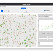
Daniel Vartanian Leandro Garcia Aline | Published Saturday, September 13, 2025 | Last modified Monday, July 13, 2026Logônia is a NetLogo model that simulates the growth response of a fictional plant, Logônia, under different climatic conditions. The model uses climate data from WorldClim 2.1 (Fick & Hijmans, 2017) and demonstrates how to integrate the LogoClim model through the LevelSpace extension.
The model was developed according to the FAIR principles for research software (Barker et al., 2022) and is openly available on the CoMSES Network and GitHub.
Displaying 10 of 825 results NetLogo clear search