Our mission is to help computational modelers develop, document, and share their computational models in accordance with community standards and good open science and software engineering practices. Model authors can publish their model source code in the Computational Model Library with narrative documentation as well as metadata that supports open science and emerging norms that facilitate software citation, computational reproducibility / frictionless reuse, and interoperability. Model authors can also request private peer review of their computational models. Models that pass peer review receive a DOI once published.
All users of models published in the library must cite model authors when they use and benefit from their code.
Please check out our model publishing tutorial and feel free to contact us if you have any questions or concerns about publishing your model(s) in the Computational Model Library.
Displaying 10 of 837 results for "Blanca Gonzalez-Mon" clear search
Peer reviewed Co-adoption of low-carbon household energy technologies
Mart van der Kam Maria Lagomarsino Elie Azar Ulf Hahnel David Parra | Published Tuesday, August 29, 2023 | Last modified Friday, February 23, 2024The model simulates the diffusion of four low-carbon energy technologies among households: photovoltaic (PV) solar panels, electric vehicles (EVs), heat pumps, and home batteries. We model household decision making as the decision marking of one person, the agent. The agent decides whether to adopt these technologies. Hereby, the model can be used to study co-adoption behaviour, thereby going beyond traditional diffusion models that focus on the adop-tion of single technologies. The combination of these technologies is of particular interest be-cause (1) using the energy generated by PV solar panels for EVs and heat pumps can reduce emissions associated with transport and heating, respectively, and (2) EVs, heat pumps, and home batteries can help to integrate PV solar panels in local electricity grids by offering flexible demand (EVs and heat pumps) and energy storage (home batteries and EVs), thereby reducing grid impacts and associated upgrading costs.
The purpose of the model is to represent realistic adoption and co-adoption behaviour. This is achieved by grounding the decision model on the risks-as-feelings model (Loewenstein et al., 2001), theory from environmental and social psychology, and empirically informing agent be-haviour by survey-data among 1469 people in the Swiss region Romandie.
The model can be used to construct scenarios for the diffusion of the four low-carbon energy technologies depending on different contexts, and as a virtual experimentation environment for ex ante evaluation of policy interventions to stimulate adoption and co-adoption.
Evolution of cooperative strategies from first principles
Marco Janssen | Published Monday, January 04, 2010 | Last modified Saturday, April 27, 2013The purpose of this model is to study the evolution of cooperation when agents are endowed with a limited set of receptors, a set of elementary actions and a neural network agents use to make decision
Peer reviewed Routes & Rumours 0.1.1
Jakub Bijak Martin Hinsch Oliver Reinhardt | Published Tuesday, July 12, 2022Routes & Rumours is an agent-based model of (forced) human migration. We model the formation of migration routes under the assumption that migrants have limited geographical knowledge concerning the transit area and rely to a large degree on information obtained from other migrants.
Alternative Fuel Design/Consumer Choice Model
Rosanna Garcia | Published Wednesday, September 22, 2010 | Last modified Saturday, April 27, 2013This is a model of the diffusion of alternative fuel vehicles based on manufacturer designs and consumer choices of those designs. It is written in Netlogo 4.0.3. Because it requires data to upload
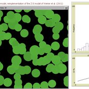
Peer reviewed AZOI: Another Zone Of Influence model
Cyril Piou | Published Wednesday, July 23, 2014 | Last modified Thursday, December 11, 2014This model reimplement Weiner et al. 2001 Zone Of Influence model to simulate plant growth under competition. The reimplementation in Netlogo and the ODD description in the “info” tab try to be as consistent as possible with the original paper.

Cluster Analysis
Lars Spång | Published Sunday, January 14, 2018This model illustrates how to apply a simple cluster-analysis on points distributed around 5 centers. The result can be displayed in shades of a color or a spectacular colored pattern.
Agent Based Integrated Assessment Model
Marcin Czupryna | Published Saturday, June 27, 2020Agent based approach to the class of the Integrated Assessment Models. An agent-based model (ABM) that focuses on the energy sector and climate relevant facts in a detailed way while being complemented with consumer goods, labour and capital markets to a minimal necessary extent.
Wolf-sheep predation Netlogo model, extended, with foresight
Guido Fioretti Andrea Policarpi | Published Wednesday, September 16, 2020 | Last modified Tuesday, April 13, 2021This model is an extension of the Netlogo Wolf-sheep predation model by U.Wilensky (1997). This extended model studies several different behavioural mechanisms that wolves and sheep could adopt in order to enhance their survivability, and their overall impact on global equilibrium of the system.
A Model of the Gender Cliff in the Relative Contribution to the Household Income
André Grow Jan Van Bavel | Published Wednesday, December 18, 2019In Western countries, the distribution of relative incomes within marriages tends to be skewed in a remarkable way. Husbands usually do not only earn more than their female partners, but there also is a striking discontinuity in their relative contributions to the household income at the 50/50 point: many wives contribute just a bit less than or as much as their husbands, but few contribute more. Our model makes it possible to study a social mechanism that might create this ‘cliff’: women and men differ in their incomes (even outside marriage) and this may differentially affect their abilities to find similar- or higher-income partners. This may ultimately contribute to inequalities within the households that form. The model and associated files make it possible to assess the merit of this mechanism in 27 European countries.
Biodiversity and Adoption of Small-scale Agroforestry in Rwanda (BASAR)
Beatrice Nöldeke Etti Winter Elisée Bahati Ntawuhiganayo | Published Friday, July 15, 2022The BASAR model aims to investigate different approaches to describe small-scale farmers’ decision-making in the context of diversified agroforestry adoption in rural Rwanda. Thereby, it compares random behaviour with perfect rationality (non-discounted and discounted utility maximization), bounded rationality (satisficing and fast and frugal decision tree heuristics), Theory of Planned Behaviour, and a probabilistic regression-based approach. It is aimed at policy-makers, extension agents, and cooperatives to better understand how rural farmers decide about implementing innovative agricultural practices such as agroforestry and at modelers to support them in selecting an approach to represent human decision-making in ABMs of Social-Ecological Systems. The overall objective is to identify a suitable approach to describe human decision-making and therefore improve forecasts of adoption rates and support the development and implementation of interventions that aim to raise low adoption rates.
Displaying 10 of 837 results for "Blanca Gonzalez-Mon" clear search