Our mission is to help computational modelers develop, document, and share their computational models in accordance with community standards and good open science and software engineering practices. Model authors can publish their model source code in the Computational Model Library with narrative documentation as well as metadata that supports open science and emerging norms that facilitate software citation, computational reproducibility / frictionless reuse, and interoperability. Model authors can also request private peer review of their computational models. Models that pass peer review receive a DOI once published.
All users of models published in the library must cite model authors when they use and benefit from their code.
Please check out our model publishing tutorial and feel free to contact us if you have any questions or concerns about publishing your model(s) in the Computational Model Library.
Displaying 10 of 266 results for "Ala Jlif" clear search
Peer reviewed Empathy & Power
J M Applegate Ned Wellman | Published Monday, November 13, 2017 | Last modified Thursday, December 21, 2017The purpose of this model is to explore the effects of different power structures on a cross-functional team’s prosocial decision making. Are certain power distributions more conducive to the team making prosocial decisions?
Peer reviewed COMOKIT
Patrick Taillandier Alexis Drogoul Benoit Gaudou Kevin Chapuis Nghi Huyng Quang Doanh Nguyen Ngoc Arthur Brugière Pierre Larmande Marc Choisy Damien Philippon | Published Tuesday, May 26, 2020 | Last modified Wednesday, July 01, 2020In the face of the COVID-19 pandemic, public health authorities around the world have experimented, in a short period of time, with various combinations of interventions at different scales. However, as the pandemic continues to progress, there is a growing need for tools and methodologies to quickly analyze the impact of these interventions and answer concrete questions regarding their effectiveness, range and temporality.
COMOKIT, the COVID-19 modeling kit, is such a tool. It is a computer model that allows intervention strategies to be explored in silico before their possible implementation phase. It can take into account important dimensions of policy actions, such as the heterogeneity of individual responses or the spatial aspect of containment strategies.
In COMOKIT, built using the agent-based modeling and simulation platform GAMA, the profiles, activities and interactions of people, person-to-person and environmental transmissions, individual clinical statuses, public health policies and interventions are explicitly represented and they all serve as a basis for describing the dynamics of the epidemic in a detailed and realistic representation of space.
…
RiskNetABM
Birgit Müller Jürgen Groeneveld Karin Frank Meike Will Friederike Lenel | Published Monday, July 20, 2020 | Last modified Monday, May 03, 2021The fight against poverty is an urgent global challenge. Microinsurance is promoted as a valuable instrument for buffering income losses due to health or climate-related risks of low-income households in developing countries. However, apart from direct positive effects they can have unintended side effects when insured households lower their contribution to traditional arrangements where risk is shared through private monetary support.
RiskNetABM is an agent-based model that captures dynamics between income losses, insurance payments and informal risk-sharing. The model explicitly includes decisions about informal transfers. It can be used to assess the impact of insurance products and informal risk-sharing arrangements on the resilience of smallholders. Specifically, it allows to analyze whether and how economic needs (i.e. level of living costs) and characteristics of extreme events (i.e. frequency, intensity and type of shock) influence the ability of insurance and informal risk-sharing to buffer income shocks. Two types of behavior with regard to private monetary transfers are explicitly distinguished: (1) all households provide transfers whenever they can afford it and (2) insured households do not show solidarity with their uninsured peers.
The model is stylized and is not used to analyze a particular case study, but represents conditions from several regions with different risk contexts where informal risk-sharing networks between smallholder farmers are prevalent.
…
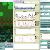
Peer reviewed LUCID: Land Use Competition In Drylands
Birgit Müller Gunnar Dressler Lance Robinson | Published Wednesday, April 12, 2023The Land Use Competition in Drylands (LUCID) model is a stylized agent-based model of a smallholder farming system. Its main purpose is to illustrate how competition between pastoralism and crop cultivation can affect livelihoods of households, specifically their food security. In particular, the model analyzes whether the expansion of crop cultivation may contribute to a vicious circle where an increase in cultivated area leads to higher grazing pressure on the remaining pastureland, which in turn may cause forage shortages and livestock loss for households which are then forced to further expand their cultivated area in order to increase their food security. The model does not attempt to replicate a particular case study but to generate a general understanding of mechanisms and drivers of such vicious circles and to identify possible scenarios under which such circles may be prevented.
The model is inspired by observations of the Borana land use system in Southern Ethiopia. The climatic and ecological conditions of the Borana zone favor pastoralism, and traditionally livelihoods have been based mainly on livestock keeping. Recent years, however, have seen an advancement of crop cultivation as a coping strategy, e.g., to compensate the loss of livestock, even though crop yields are low on average and successful harvests are infrequent.
In the model, it is possible to evaluate patterns of individual (single household) as well as overall (across all households) consumption and food security, depending on a range of ecological, climatic and management parameters.
Feedback Loop Example: Forest Resource Transport
James Millington | Published Friday, December 21, 2012 | Last modified Saturday, April 27, 2013This model illustrates a positive ‘transport’ feedback loop in which lines with different resistance to flows of material result in variation in rates of change in linked entities.
Peer reviewed Umwelten Ants
Kit Martin | Published Thursday, January 15, 2015 | Last modified Thursday, August 27, 2015Simulates impacts of ants killing colony mates when in conflict with another nest. The murder rate is adjustable, and the environmental change is variable. The colonies employ social learning so knowledge diffusion proceeds if interactions occur.
PowerGen-ABM
Muhammad Indra Al Irsyad Anthony Halog Rabindra Nepal Deddy Priatmodjo Koesrindartoto | Published Sunday, August 04, 2019PowerGen-ABM is an optimisation model for power plant expansions from 2010 to 2025 with Indonesian electricity systems as the case study. PowerGen-ABM integrates three approaches: techno-economic analysis (TEA), linear programming (LP), and input-output analysis (IOA) and environmental analysis. TEA is based on the revenue requirement (RR) formula by UCDavis (2016), and the environmental analysis accounts for resource consumption (i.e., steel, concrete, aluminium, and energy) and carbon dioxide equivalent (CO2e) emissions during the construction and operational stages of power plants.
Peer reviewed The Andean Resource Management Model (ARMM)
Olga Palacios | Published Tuesday, January 20, 2026ARMM is a theoretical agent-based model that formalizes Murra’s Theory of Verticality (Murra, 1972) to explore how multi-zonal resource management systems emerge in mountain landscapes. The model identifies the social, political, and economic mechanisms that enable vertical complementarity across ecological gradients.
Built in NetLogo, ARMM employs an abstract 111×111 grid divided into four Andean ecological zones (Altiplano, Highland, Lowland, Coast), each containing up to 18 resource types distributed according to ecological suitability. To test general theoretical principles rather than replicate specific geography, resource locations are randomized at each model initialization.
Settlement agents pursue one of two economic strategies: diversification (seeking resource variety, maximum 2 units per type) or accumulation (maximising total quantity, maximum 30 units). Agents move between adjacent zones through hierarchical decision-making, first attempting peaceful interactions—coexistence (governed by tolerance) and trading (governed by cooperation)—before resorting to conflict (theft or takeover, governed by belligerence).
The model demonstrates that vertical complementarity can emerge through fundamentally different mechanisms: either through autonomous mobility under political decentralization or through state-coordinated redistribution under centralization. Sensitivity analysis reveals that belligerence and economic strategy explain approximately 25% of outcome variance, confirming that structural inequalities between zones result from political-economic organization rather than environmental constraints alone.
As a preliminary theoretical model, ARMM intentionally maintains simplicity to isolate core mechanisms and generate testable hypotheses. This foundational framework will guide future empirically-calibrated versions that incorporate specific archaeological settlement data and geographic features from the Carangas region (Bolivia-Chile border), enabling direct comparison between theoretical predictions and observed historical patterns.
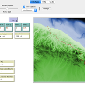
Peer reviewed Least cost path mobility
Colin Wren Claudine Gravel-Miguel | Published Saturday, September 02, 2017 | Last modified Monday, October 04, 2021This model aims to mimic human movement on a realistic topographical surface. The agent does not have a perfect knowledge of the whole surface, but rather evaluates the best path locally, at each step, thus mimicking imperfect human behavior.
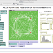
ABODE - Agent Based Model of Origin Destination Estimation
D Levinson | Published Monday, August 29, 2011 | Last modified Saturday, April 27, 2013The agent based model matches origins and destinations using employment search methods at the individual level.
Displaying 10 of 266 results for "Ala Jlif" clear search