About the CoMSES Model Library more info
Our mission is to help computational modelers develop, document, and share their computational models in accordance with community standards and good open science and software engineering practices. Model authors can publish their model source code in the Computational Model Library with narrative documentation as well as metadata that supports open science and emerging norms that facilitate software citation, computational reproducibility / frictionless reuse, and interoperability. Model authors can also request private peer review of their computational models. Models that pass peer review receive a DOI once published.
All users of models published in the library must cite model authors when they use and benefit from their code.
Please check out our model publishing tutorial and feel free to contact us if you have any questions or concerns about publishing your model(s) in the Computational Model Library.
We also maintain a curated database of over 7500 publications of agent-based and individual based models with detailed metadata on availability of code and bibliometric information on the landscape of ABM/IBM publications that we welcome you to explore.
Displaying 10 of 518 results for "Jingjing Cai" clear search
Importing a Roman transport network
Tom Brughmans | Published Sunday, September 30, 2018A draft model teaching how a Roman transport model can be imported into Netlogo, and the issues confronted when importing and reusing open access Roman datasets. This model is used for the tutorial:
Brughmans, T. (2018). Importing a Roman Transport network with Netlogo, Tutorial, https://archaeologicalnetworks.wordpress.com/resources/#transport .
Social and Task Interdependencies in Innovation Implementation
Spiro Maroulis Uri Wilensky | Published Tuesday, June 04, 2013 | Last modified Tuesday, March 04, 2014This is a model of innovation implementation inside an organization. It characterizes an innovation as a set of distributed and technically interdependent tasks performed by a number of different and socially interconnected frontline workers.
Exploring Transitions towards Sustainable Construction
Jesus Rosales-Carreon César García-Díaz | Published Wednesday, October 30, 2013 | Last modified Saturday, January 31, 2015This model illustrates actor interaction in the construction sector, according to information gathered in NL. It offers a simple frame to represent diverse interests, interdependencies and effects on the number of built sustainable houses.
Peer reviewed PPHPC - Predator-Prey for High-Performance Computing
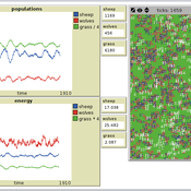
Nuno Fachada | Published Saturday, August 08, 2015 | Last modified Wednesday, November 25, 2015PPHPC is a conceptual model for studying and evaluating implementation strategies for spatial agent-based models (SABMs). It is a realization of a predator-prey dynamic system, and captures important SABMs characteristics.
Inquisitiveness in ad hoc teams
Davide Secchi | Published Sunday, October 18, 2015 | Last modified Thursday, June 11, 2020This model builds on inquisitiveness as a key individual disposition to expand the bounds of their rationality. It represents a system where teams are formed around problems and inquisitive agents integrate competencies to find ‘emergent’ solutions.
STECCAR: a simulation of the diffusion of electric cars
A Kangur Lc Verbrugge W Jager M Bockarjova | Published Sunday, November 29, 2015In this Repast model the ‘Consumat’ cognitive framework is applied to an ABM of the Dutch car market. Different policy scenarios can be selected or created to examine their effect on the diffusion of EVs.
Social norms and the dominance of Low-doers
Antonio Franco | Published Wednesday, July 13, 2016 | Last modified Sunday, December 02, 2018The code for the paper “Social norms and the dominance of Low-doers”
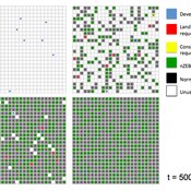
BESTMAP-ABM-DE is an agent-based model to determine the adoption and spatial allocation of selected agri-environmental schemes (AES) by individual farmers in the Mulde River Basin located in Western Saxony, Germany. The selected AES are buffer areas, cover crops, maintaining permanent grassland and conversion of arable land to permanent grassland. While the first three schemes have already been offered in the case study area, the latter scheme is a hypothetical scheme designed to test the impact of potential policy changes. For the first model analyses, only the currently offered schemes are considered. With the model, the effect of different scenarios of policy design on patterns of adoption can be investigated. In particular, the model can be used to study the social-ecological consequences of agricultural policies at different spatial and temporal scales and, in combination with biophysical models, test the ecological implications of different designs of the EU’s Common Agricultural Policy. The model was developed in the BESTMAP project.
External shocks, agent interactions, and endogenous feedbacks--investigating system resilience with a stylized land use model
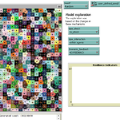
Yang Chen | Published Tuesday, March 06, 2018The purpose of the presented ABM is to explore how system resilience is affected by external disturbances and internal dynamics by using the stylized model of an agricultural land use system.
We explore land system resilience with a stylized land use model in which agents’ land use activities are affected by external shocks, agent interactions, and endogenous feedbacks. External shocks are designed as yield loss in crops, which is ubiquitous in almost every land use system where perturbations can occur due to e.g. extreme weather conditions or diseases. Agent interactions are designed as the transfer of buffer capacity from farmers who can and are willing to provide help to other farmers within their social network. For endogenous feedbacks, we consider land use as an economic activity which is regulated by markets — an increase in crop production results in lower price (a negative feedback) and an agglomeration of a land use results in lower production costs for the land use type (a positive feedback).
Style_Net_01
Andrew White | Published Tuesday, August 03, 2021Style_Net_01 is a spatial agent-based model designed to serve as a platform for exploring geographic patterns of tool transport and discard among seasonally mobile hunter-gatherer populations. The model has four main levels: artifact, person, group, and system. Persons make, use, and discard artifacts. Persons travel in groups within the geographic space of the model. The movements of groups represent a seasonal pattern of aggregation and dispersal, with all groups coalescing at an aggregation site during one point of the yearly cycle. The scale of group mobility is controlled by a parameter. The creation, use, and discard of artifacts is controlled by several parameters that specify how many tools each person carries in a personal inventory, how many times each tool can be used before it is discarded, and the frequency of tool usage. A lithic source (representing a geographically-specific, recognizable source of stone for tools) can be placed anywhere in the geographic space of the model.
Displaying 10 of 518 results for "Jingjing Cai" clear search
