Our mission is to help computational modelers develop, document, and share their computational models in accordance with community standards and good open science and software engineering practices. Model authors can publish their model source code in the Computational Model Library with narrative documentation as well as metadata that supports open science and emerging norms that facilitate software citation, computational reproducibility / frictionless reuse, and interoperability. Model authors can also request private peer review of their computational models. Models that pass peer review receive a DOI once published.
All users of models published in the library must cite model authors when they use and benefit from their code.
Please check out our model publishing tutorial and feel free to contact us if you have any questions or concerns about publishing your model(s) in the Computational Model Library.
Displaying 10 of 381 results for "Jonathan Marino" clear search
The effect of error on cultural transmission
Claudine Gravel-Miguel | Published Thursday, November 01, 2012 | Last modified Saturday, April 27, 2013This is the replication of the experiment performed by Eerkens and Lipo (2005) to look at the effect of copying errors when specific traits are transferred from an individual to another.
Rangeland and evolution of management styles
Marco Janssen | Published Tuesday, January 14, 2020 | Last modified Friday, June 26, 2026Provided is a landscape of properties where pastoralists make decisions how much livestock they put on their property and how much to suppress fire from occuring. Rangelands can be grass dominated, or unproductive shrubb dominated. Overgrazing and fire suppresion lead to shrub dominated landscapes. What management strategies evolve, and how is this impacted by policies?
The model is discussed in Introduction to Agent-Based Modeling by Marco Janssen. For more information see https://intro2abm.com/.
Spatial rangeland model
Marco Janssen | Published Tuesday, January 22, 2019 | Last modified Friday, June 26, 2026Spatial explicit model of a rangeland system, based on Australian conditions, where grass, woody shrubs and fire compete fore resources. Overgrazing can cause the system to flip from a healthy state to an unproductive shrub state. With the model one can explore the consequences of different movement rules of the livestock on the resilience of the system.
The model is discussed in Introduction to Agent-Based Modeling by Marco Janssen. For more information see https://intro2abm.com/.
Peer reviewed SWIRS Spread of a woody invader in riparian systems
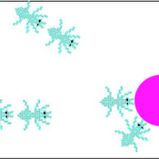
Moira Zellner Beatriz Sosa Carlos Andrés Chiale | Published Tuesday, May 09, 2023Riparian forests are one of the most vulnerable ecosystems to the development of biological invasions, therefore limiting their spread is one of the main challenges for conservation. The main factors that explain plant invasions in these ecosystems are the capacity for both short- and long-distance seed dispersion, and the occurrence of suitable habitats that facilitate the establishment of the invasive species. Large floods constitute an abiotic filter for invasion.
This model simulates the spatio-temporal spread of the woody invader Gleditsia. triacanthos in the riparian forest of the National Park Esteros de Farrapos e Islas del Río Uruguay, a riparian system in the coast of the Uruguay river (South America). In this model, we represent different environmental conditions for the development of G. triacanthos, long- and short-distance spread of its fruits, and large floods as the main factor of mortality for fruit and early stages.
Field results show that the distribution pattern of this invasive species is limited by establishment, i.e. it spreads locally through the expansion of small areas, and remotely through new invasion foci. This model recreates this dispersion pattern. We use this model to derive management implications to control the spread of G. triacanthos
The Pampas Model: An agent-based model of agricultural systems in the Argentinean Pampas
Michael North Federico Bert Guillermo P Podestá Santiago L Rovere Charles Macal | Published Tuesday, July 16, 2013 | Last modified Tuesday, February 17, 2015The Pampas Model is an Agent-Based Model intended to explore the dynamics of structural and land use changes in agricultural systems of the Argentine Pampas in response to climatic, technological economic, and political drivers.
Linear recruitment leads to allocation and flexibility in collective foraging by ants
Takao Sasaki Zachary Joseph Shaffer Stephen Pratt | Published Thursday, July 11, 2013 | Last modified Thursday, September 05, 2013Ants in the genus Temnothorax use tandem runs (rather than pheromone trails) to recruit to food sources. This model explores the collective consequences of this linear recruitment (as opposed to highly nonlinear pheromone trails).
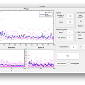
An Agent Based Model for implementing a double auction financial market
Annalisa Fabretti | Published Thursday, April 14, 2016The model implements a double auction financial markets with two types of agents: rational and noise. The model aims to study the impact of different compensation structure on the market stability and market quantities as prices, volumes, spreads.
Peninsula_Iberica 1.0
Carolina Cucart-Mora Sergi Lozano Javier Fernández-López De Pablo | Published Friday, November 04, 2016 | Last modified Monday, November 27, 2017This model was build to explore the bio-cultural interaction between AMH and Neanderthals during the Middle to Upper Paleolithic Transition in the Iberian Peninsula
Human-in-the-loop Experiment of the Strategic Coalition Formation using the glove game
Andrew Collins | Published Monday, November 23, 2020 | Last modified Wednesday, June 22, 2022The purpose of the model is to collect information on human decision-making in the context of coalition formation games. The model uses a human-in-the-loop approach, and a single human is involved in each trial. All other agents are controlled by the ABMSCORE algorithm (Vernon-Bido and Collins 2020), which is an extension of the algorithm created by Collins and Frydenlund (2018). The glove game, a standard cooperative game, is used as the model scenario.
The intent of the game is to collection information on the human players behavior and how that compares to the computerized agents behavior. The final coalition structure of the game is compared to an ideal output (the core of the games).
Fire-WCISG
Sven Christ | Published Saturday, July 25, 2026An integrated wildfire and urban growth model for informal settlements.
Fire-WCISG is developed to test the impact of different fire management strategies on the number and type of residents staying in an informal settlement, and the fire-dependent fynbos vegetation that it is next to.
The model uses a hybrid protection motivation theory, place attachment and Turner’s informal residents as described by Christ et al. (2023) (10.1016/j.habitatint.2023.102815), for the agents decision making. Wildland vegetation is based on published understanding of fynbos ecology.
…
Displaying 10 of 381 results for "Jonathan Marino" clear search